

Stanley North’s 1924 London & World maps
In 1924, Stanley Kennedy North drew two maps, one for the Thomas Cook tourist business and the other a London transport map for the 1924 British Empire Exhibition (the one featured in The King’s Speech).
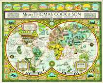

The Cook’s world map shows some of the steamer routes of the time, and has many genial comments. In this copy, SKN has made a handwritten inscription, “To dear old Paul from Daddy, Feb 6, 1925”. This map is strikingly similar in tone to the lovely work of MacDonald “Max” Gill.
If you would like to view the World Map in a fully-zoomable version by all means use this link. It will take you to a page in which the map is also annotated. (A work in progress.)
The British Empire Exhibition transport map shows a schematic version of the London Uuderground which is, I think, a novel halfway staging point between the “geographical” representations of MacDonald “Max” Gill (which were contemporaneous with SKN’s work) and highly schematic (and much more famous) 1933 map by Harry Beck.
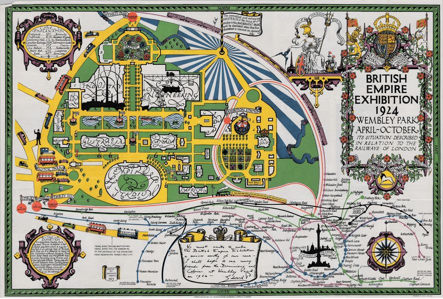
If you would like to see a fully zoomable version of the above map by all means click here.
Leave a comment